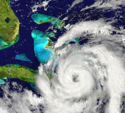
The 2017 Atlantic hurricane season got an early start with Arlene in April, but the most powerful storms didn’t start to hit until the last week of August, when Hurricane Harvey flooded Texas and Louisiana.
Harvey was the first hurricane to make landfall in Texas since Ike in 2008, and the first Category 4 hurricane in Texas since Carla in 1961.
Irma, the 11th strongest Atlantic storm on record (using central pressure, the most reliable measure), had major impacts on Barbuda, St. Martin, the Virgin Islands, the Turks and Caicos, and southern Bahamas. After crossing northern Cuba, it curled back into Florida.
Irma was the first land-falling hurricane and major hurricane in Florida since Wilma in 2005. Since Irma landed, the United States has been hit by Hurricane Maria, a Category 5 storm which battered Puerto Rico and the U.S. Virgin Islands, and Hurricane Nate, a Category 1 storm that hit first at the mouth of the Mississippi River.
Twelve-Year Lull
Before the landfall of these three major storms, the United States had experienced almost 12 years without a major hurricane making landfall, the longest such lull since the 1860s. The recent quiet period came after three big years for storms: Isabel made landfall on the mid-Atlantic in 2003; Charley, Frances, Ivan, and Jeanne made landfall in 2004; and Dennis, Katrina, Rita, and Wilma made landfall in 2005.
The waxing and waning of powerful hurricane seasons is not new. Great colonial hurricanes in the Northeast, with storm surges of up to 20 feet, occurred in 1635 and 1675. A Katrina-like storm made landfall in Louisiana in 1722, causing major flooding and damage. The Great Chesapeake Storm in 1769, like Isabel in 2003, brought major flooding to North Carolina and Virginia.
The Great Hurricane of 1780 ravaged the islands of the eastern Caribbean with winds estimated as topping 200 mph, killing an estimated 27,500 people. It was one of three hurricanes that year with death tolls greater than 1,000.
In 1893, there were at least 10 hurricanes, five of which were major hurricanes. Two of the hurricanes caused more than 2,000 deaths apiece in the United States. At the time, that was the deadliest hurricane season in U.S. history. In 1900, the Galveston hurricane killed at least 8,000 people (some estimates are as high as 12,000), making it the deadliest natural disaster in U.S. history.
Major hurricanes have occurred throughout history, even during cold periods, and there is no evident trend toward more or more powerful hurricanes in the modern record.
Measuring Tropical Storm Activity
The Accumulated Cyclone Energy (ACE) Index takes into account the number, duration, and strength of all tropical storms in a season. The ACE Index for the Atlantic Ocean shows cyclical behavior, with no long-term trend but with spikes in 1893, 1926, 1933, and 1950, and then again in 1995, 2004, and 2005.
The year 2017 now ranks eighth, with weeks to go in the season, which ends November 30.
Ocean Temperature, Pressure Patterns
Long breaks between periods of major hurricanes are not unusual.
Hurricane numbers and severity are in large part driven by changes in ocean patterns. The North Atlantic, like the Pacific Ocean, undergoes multi-decadal oscillations in ocean temperature and pressure patterns. It has long been known that when the Atlantic is in what is called its “warm mode,” there are more storms than usual. Since 1995, when the current warm mode in the Atlantic began, there has been an average of 14.6 named storms per year, greater than five more than the long-term average during the 1851–2017 period.
El Niño, La Niña
An important factor affecting whether hurricanes impact the United States is whether there is an El Niño or La Niña phenomenon in Pacific Ocean sea surface temperatures. When El Niños develop, more storms occur in the eastern and central Pacific, threatening Hawaii, Mexico, and sometimes Arizona and California, albeit in weakened forms.
These storms enhance high-level winds that cross into the Atlantic. These winds produce shear that disrupts developing storms, causing them to weaken or dissipate and/or turn harmlessly north into the North Atlantic. When La Niñas develop, there are usually fewer storms in the eastern Pacific and less shear to disrupt the Atlantic storms.
In warm Atlantic years, this situation creates trouble, as the storms can track the entire Atlantic Basin with more than enough time to transform into major hurricanes. The East Coast is also more vulnerable to land-falling hurricanes under these circumstances. There were eight high-impact East Coast hurricanes from 1938 to 1960, and nine from 1988 to 2012.
The most recent important La Niña stretch occurred from 2010 to 2012. During this period, the United States avoided a major hurricane, but major hurricanes at sea made final landfall in the New York City area (Irene, as a tropical storm in 2011, and Sandy, as a post-tropical cyclone in 2012).
In 2017, La Niña-like conditions developed again. The warm water and lack of shear contributed to giant storms developing, just as in 2004 and 2005. This pattern may not be over yet. In 2005, Hurricane Wilma didn’t strike until late October.
When the United States experiences another year similar to 2017—or back-to-back bad years, as it did in 2004 and 2005—people should understand it does not provide evidence of human-caused climate change. Instead, this is how the weather, driven by natural oceanic patterns, works.
Joseph D’Aleo ([email protected]) is currently with WeatherBELL Analytics. He is a cofounder and the first director of meteorology at The Weather Channel and the executive director of Icecap.us.

Joseph S. D’Aleo is a graduate of the University of Wisconsin BS, MS and did his doctoral studies at NYU. He is a policy advisor to The Heartland Institute.